-
Share this page
SLUMAP project
Slum Mapping and Characterisation in sub-Saharan African Cities
Website: http://slumap.ulb.be/
Researcher(s):- Sabine Vanhuysse
- Stefanos Georganos
- Taïs Grippa
- Angela Abascal
Description
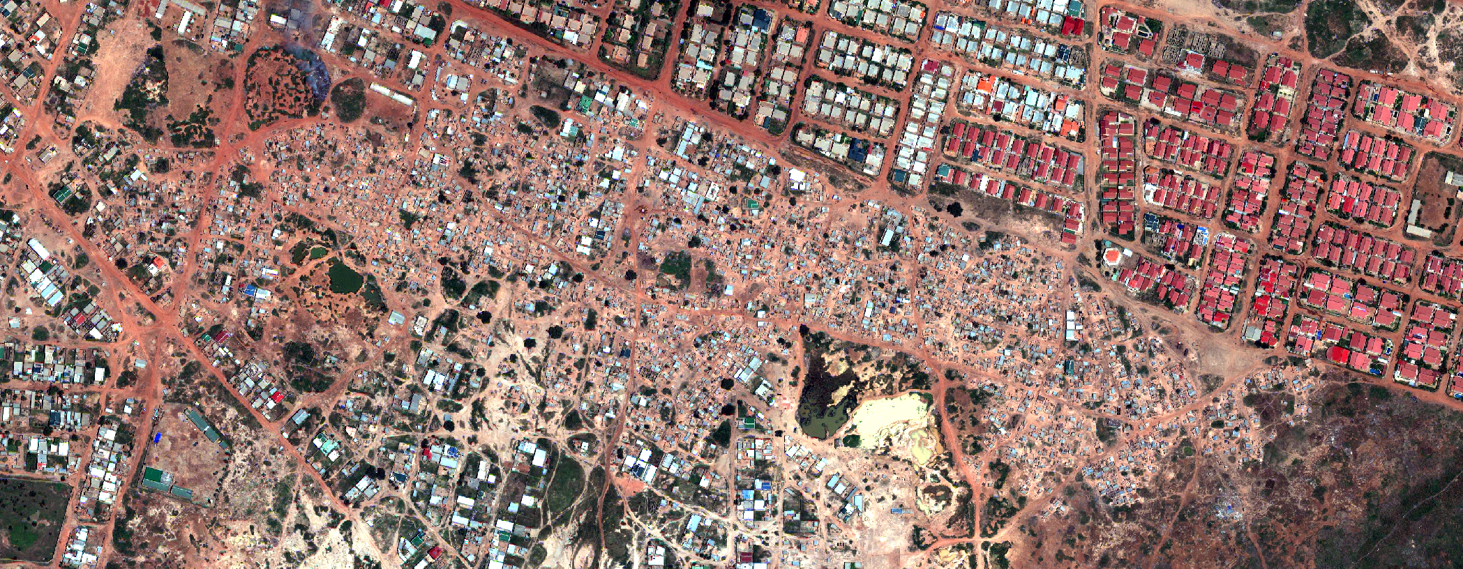
With rapid urbanization leading to the proliferation of deprived urban areas (often referred to as “slums”) in sub-Saharan Africa, there is a growing number of city dwellers living in inadequate housing conditions and being exposed to multiple hazards. However, there are huge data gaps in geospatial data on these areas for informing stakeholders and decision-makers on different levels, form local to international. The research project SLUMAP is an effort to develop an open-source framework with suitable methods and tools for mapping and characterising deprived areas in sub-Saharan Africa (SSA), considering costs, benefits, and user information requirements. Our methods are being tested on three cities, namely Nairobi (Kenya), Kisumu (Kenya) and Ouagadougou (Burkina Faso).
At the city scale, we assess and compare the merits of different free or low-cost image datasets (Sentinel-1/2, SPOT...) for mapping the location and extent of deprived areas. We develop automated state-of-the-art workflows based on free open-source software (FOSS), in view of favouring the scalability and transferability of the approaches. We exploit and combine a vast array of spectral, spatial and morphological features and identify from them the best predictors, for limiting data and processing costs in applications, while maintaining a high level of accuracy. To avoid stigmatizing neighbourhoods and exposing vulnerable populations, we present the results as gridded maps of morphological deprivation probability. Besides, focusing on each deprived area, we employ very-high resolution super-spectral WorldView-3 imagery (with several combinations of XS and SWIR bands) in an adapted GEOBIA/Machine Learning processing workflow to produce LULC classifications that include ad hoc classes (such as ‘Garbage piles’), and subsequently derive metrics designed to characterize deprived areas. Here also, we assess and draw conclusions on trade-offs for meeting user requirements while reducing data and processing costs.
Period
2019 - 2021
Partners
Faculty of Geo-Information Science and Earth Observation (ITC) - Twente University - Website
Funding
Research funded by BELSPO (Belgian Science Policy, research project SR/11/380) involving ULB (Université Libre de Bruxelles) and Twente University (ITC).