-
Share this page
MAUPP project
Modeling and forecasting African Urban Population Patterns
Description
The MAUPP project (Modelling and forecasting African Urban Population Patterns for vulnerability and health assessments) is a four-year research project (2014-2018) funded by the STEREO-III program of the Belgian Science Policy (BELSPO).
The main objective of MAUPP is to develop models and forecasts to improve our knowledge of sub-Saharan African urban population patterns for a wider usage of urban population distribution datasets in vulnerability and health assessments. The MAUPP project aims to contribute to the WorldPop open access archive of spatial demographic datasets.
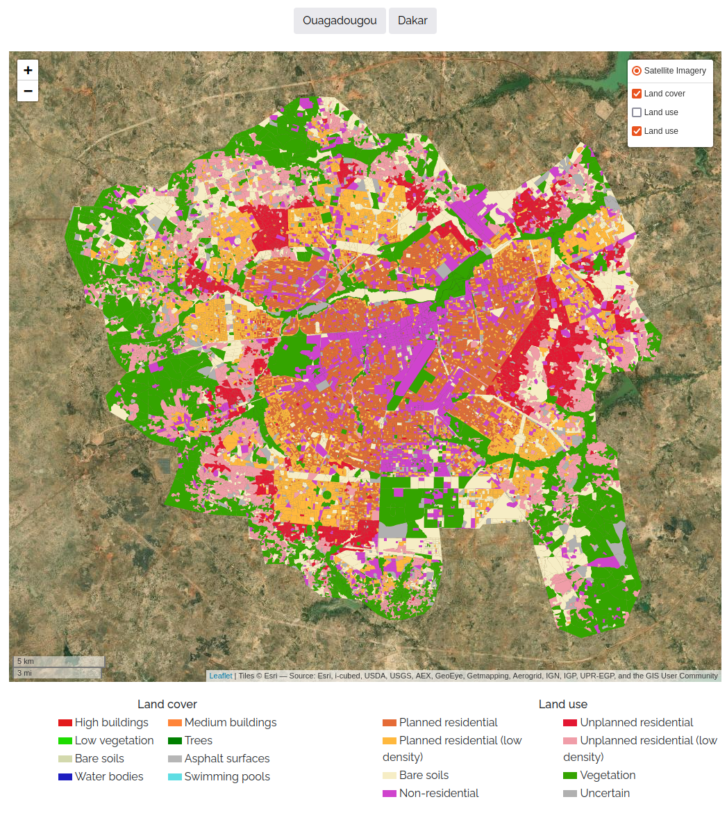
Built-up and population maps at moderate spatial resolution (12.5m) will be produced for 48 african cities and for five distinct years: 1995, 2000, 2005, 2010 and 2015. Very high spatial resolution built-up and population maps will also be produced for 2 cities: Ouagadougou (Burkina Faso) and Dakar (Senegal).
Period
2014 - 2019
Partners
Spatial Epidemiology Lab (Université Libre de Bruxelles) - Website
Signal and Image Centre (Royal Military Academy) - Website
Department of Geography and Environment (University of Southampton) - Website
Funding
Research funded by the Belgian Science Policy, research project SR/00/304.