-
Share this page
Discover the new dasymetric mapping tool
The ANAGEO team released a new GRASS-GIS add-on called “r.area.createweight”, that has been developed in the frame of the DASYWHEIGHT project (DISSUP).
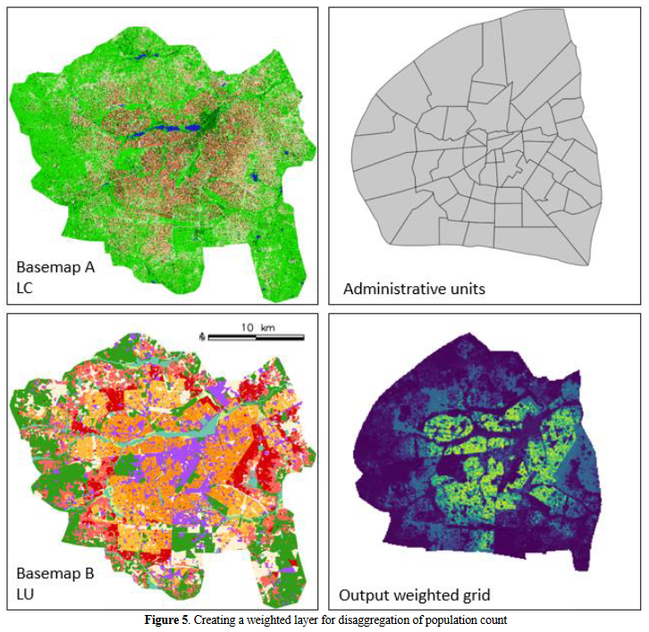
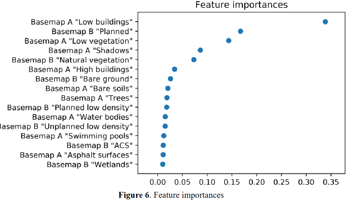
This simple and convenient ready-to-use tool facilitates the implementation of a machine-learning based approach to produce weighted layers for dasymetric mapping. Dasymetric mapping redistributes a response variable (e.g. population count) available at a coarse spatial unit level (e.g. administrative units), into a raster grid with a finer spatial resolution.
The tool can be used for a wide variety of spatial phenomena, from the mapping of human or animal populations, to the mapping of other socio-economic or environmental variables. In addition, the tool is accessible to non-programmer users, in order to encourage a more widespread uptake of these approaches.
More information about the add-on can be found on the GRASS GIS manual pages (https://grass.osgeo.org/grass78/manuals/addons/r.area.createweight.html) and in the following publication: Flasse, C., T. Grippa, et S. Fennia. 2021. « A TOOL FOR MACHINE LEARNING BASED DASYMETRIC MAPPING APPROACHES IN GRASS GIS ». The International Archives of the Photogrammetry, Remote Sensing and Spatial Information Sciences XLVI-4/W2-2021: 55‑62. DOI: https://doi.org/10.5194/isprs-archives-XLVI-4-W2-2021-55-2021